British Geological Survey
Type of resources
Available actions
Topics
Keywords
Contact for the resource
Provided by
Years
Formats
Representation types
Update frequencies
Service types
Scale
Resolution
-
Collection of individually registered specimens and cuttings from onshore boreholes drilled in England and Wales by BGS, commercial and public bodies since the establishment of BGS in 1835. The collection has been developed as part of the BGS responsibility to establish and maintain a National Borehole Collection. The collection is updated on a daily basis by the addition of new data and by the modification of existing data. The collection contains all registered borehole samples for England and Wales, Scottish borehole samples are excluded. Details of the collection are held on the 'Borehole Materials Database', and may be accessed over the internet from the BGS web site.
-
Three volumes of SAM samples (SAM1-SAM4789) exist. They represent the work of FW Anderson in the 1950s and 1960s. All samples were re-registered into other datasets. They are predominantly from the Cretaceous and Tertiary. Sample number, fossil type, locality and geological details are given, including borehole name and depth where appropriate.
-
Rocks, thin sections and paper registers: samples from past BGS surveys and projects overseas. Though neglected for several years, the collection has been re-opened for addition of new material from overseas projects and donations. Paper registers are arranged by accession order on a country by country basis. The records have not been placed in electronic format and are not currently machine readable.
-
Registers dating from the 1950s listing some of the macrofossil collections held in the Geological Survey of Ireland between 1868 and 1875. They are numbered sequentially, but as they are a selection only, there are some gaps in the numbers. Numbers included are: I1-4893; K1253-4937;L319-3247;N961-3066;O4521-5000; P1-4393; R1-1270;S1978-2099; T1-500 and U1-2113.
-
All data dictionaries held in Oracle. They include both administrative (e.g. codes for companies), scientific (e.g. codes for deformation episodes) and geographic (e.g. codes for countries). Typically, they are used to constrain the allowable values held in other Oracle datasets. In some cases they are an implementation of the classifications that the BGS uses in its work.
-
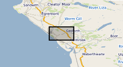
A collection of reference drawings relating to investigations carried out by Nirex, during the period from 1989 to 1997. The drawings summarise the status of the geological investigation at Sellafield and include borehole locations, geology (surface, structure, sections etc) and geophysics (seismic, airborne, etc). Sites near Sellafield, in Cumbria, and Dounreay, in Caithness. The Nirex (Nuclear Industry Radioactive Waste Executive) geological archive was transferred to the British Geological Survey during 2000/2001. The BGS has undertaken to retain the records for a minimum of 50 years as part of its national geological archive. The ownership of Nirex was transferred from the nuclear industry to the UK Government departments DEFRA and DTI in April 2005, and then to the UK's Nuclear Decommissioning Authority (NDA) in November 2006.
-
Data include geological logs and charts; letters, minutes & memos; notes; externally written reports; Internal reports; Research Reports; annotated publications, records and reports; and other miscellaneous documentation. Although some of the data go back to the first half of the 20th century (and rarely earlier), the bulk of the data refer to work carried out since about 1960. The data are filed under four subheadings: i. 1:50K sheet files (data relating to BGS mapping projects) for England & Wales, Scotland and Northern Ireland. ii. Offshore sheet files (data relating to BGS mapping projects) for the UK continental shelf and North Atlantic. iii. Offshore Quadrants (data relating to the hydrocarbons industry) (confidential). iv. Foreign biostratigraphy (in part confidential). v. General Palaeontology, Biostratigraphy & Taxonomy.
-
The foreign sliced rock or 'F' collection consists of about 10, 000 specimens and thin sections, cited by their 'F' numbers. These include material archived from recent overseas projects and much collected during the late 19th or early 20th Century from regions within what was then the British Empire. It also includes 'exotic' materials donated to the Survey in its earlier years. Its coverage varies, although there is a predominance of African material. It is indexed on paper registers, and approximately 20% has been input onto 'Britrocks'.
-
This data set is an inventory of aerial photographs held at BGS, Murchison House office and consists of a MS Excel spreadsheet containing 11 worksheets. Each worksheet contains information pertaining to the different sub-collections within the collection (9 worksheets of aerial photographs, one for aerial photograph scans, one for satellite imagery). Quality and coverage of metadata varies from worksheet to worksheet, depending on the size of the sub-collection, its pre-existing organisation, and the way in which the sub-collection was brought together (if it was not a complete entity when the inventory was started). Areal extent ranges from Shetland in the N (1200000) to the southern Lake District in the S (480000) and from Barra in the W (65000) to Stockton-on-Tees in the E (450000). By late 2001 all photos (except those being worked on by cuurently by staff) were catalogued in the inventory spreadsheet. By late 2003, the inventory spreadsheet had been updated with newly purchased and newly discovered photos as well as modified to include details of digital holdings and satellite imagery.
-
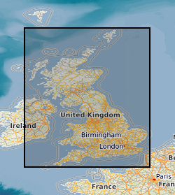
The GeoSure data sets and reports from the British Geological Survey provide information about potential ground movement or subsidence in a helpful and user-friendly format. The reports can help inform planning decisions and indicate causes of subsidence. The methodology is based on BGS DiGMap (Digital Map) and expert knowledge of the behaviour of the formations so defined. This dataset provides an assessment of slope instability. Landslide hazard occurs due to particular slope characteristics (such as geology, gradient, sources of water, drainage, man-made constructions) combining to cause the slope to become unstable. Downslope movement of materials, such as a landslide or rockfall may lead to a loss of support and damage to buildings. Complete Great Britain national coverage is available. The storage formats of the data are ESRI and MapInfo but other formats can be supplied.
 BGS Data Catalogue